Over four years ago, I wrote an article detailing some useful apps for my outdoor use.
Now that we are nearly in 2021, I thought I’d write an update. I mainly use different apps, and my use of electronics in the backcoutnry has become more streamlined over the years. I think I found the correct balance for me using a tool to supplement my current kit without the tool becoming the experience itself.
Here are the tools I plan on using for 2021. I found they sometimes enhance my outdoor experience in portable guides or complement traditional tools such as a map and compass. I use an Android. You can use most of these apps, but not all, with iOS devices.
~~~~
- Gaia GPS is our “go-to” for both pre-trip planning and in the field. We still enjoy planning and taking a large print map for an overview. But the ability to take many different map layers for seeing different facets of the region always comes in handy. We’ll make waypoints of archeological areas or campsites for future reference, taking quick map readings, and sometimes get a quick check to solve the WTF factor as well. The app I use most for the outdoors by leaps and bounds. Interested in a Gaia GPS subscription, want to save a little money, and give me a tiny commission? Check it out.
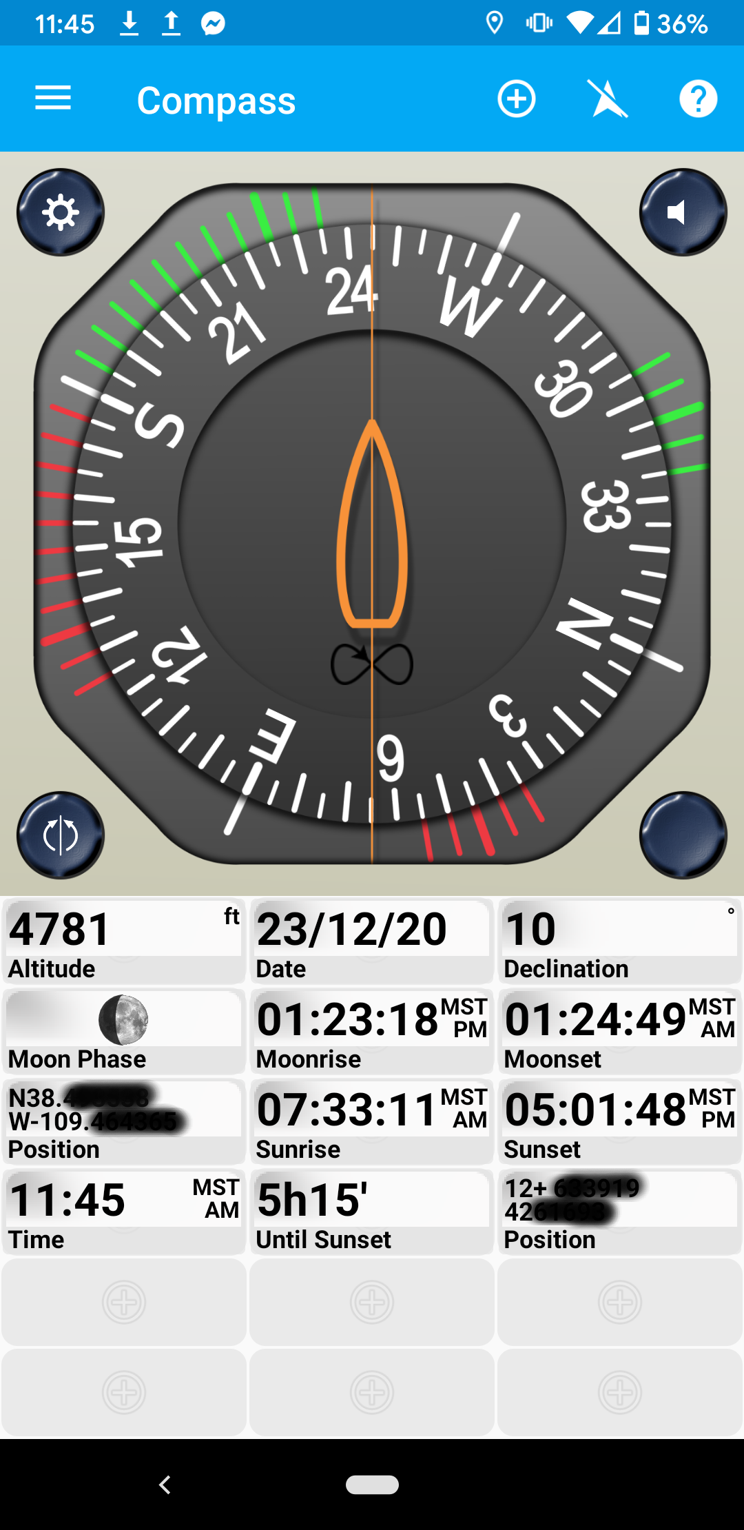
- The free GPS essentials app is the tool I use the second most frequently. Sometimes a quick compass check, but I also set up the custom dashboard to give me the information I find useful, such as sunrise and sunset times, declination, UTM and Lat/Long coordinates, altitude, etc. The dashboard setup is tricky reportedly for some but not something I found an issue with. The app uses less battery power than other apps and is esp. useful for tracking. You can export the tracks into other tools that might use more battery power for this same function.
- The NOAA Weather app is another free tool. Typically used for pre-trip planning esp when we want to make sure we won’t get stuck on muddy roads. Once in a while in the field. Simple, easy to use, and intuitive.
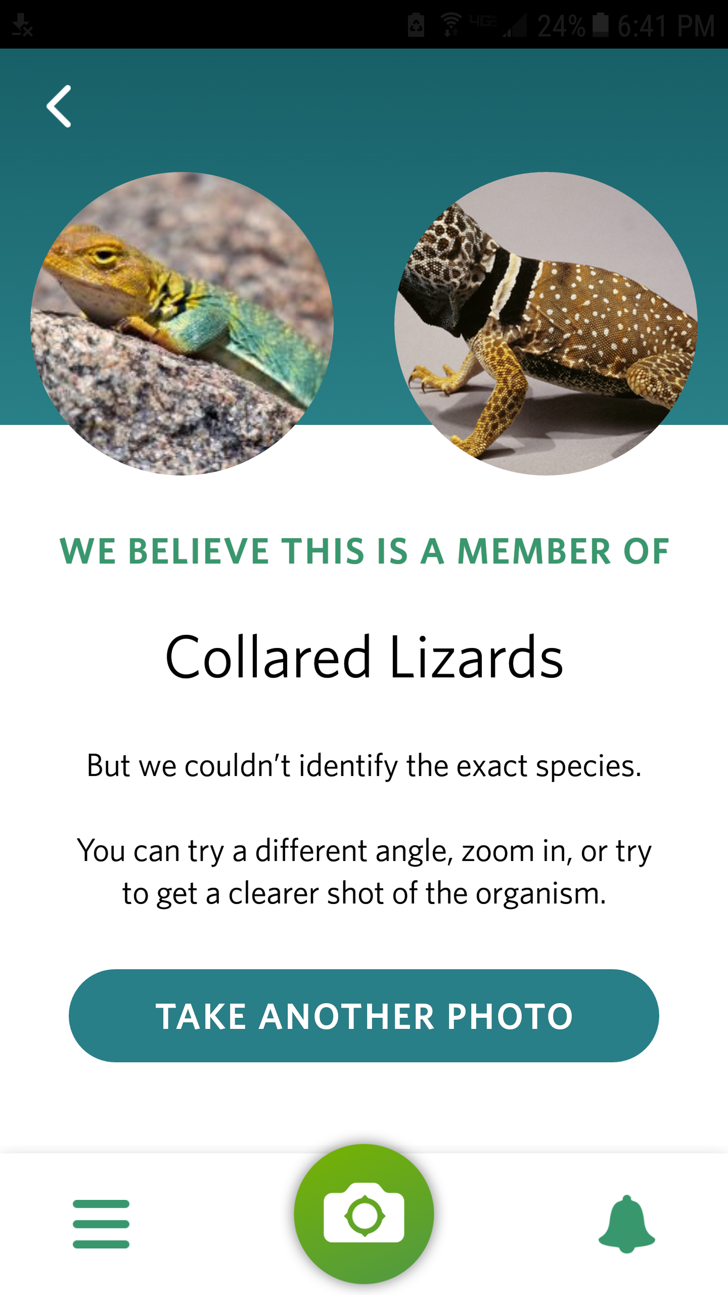
- Seek makes an excellent guidebook for all kinds of flora and fauna in a given area. The data piggybacks on the citizen science app iNaturalist. Seek’s an advantage is that the user interface has more of a casual user in mind and makes it easy to use. And you can get badges! I find I use this tool more at home after I import photos post-trip.
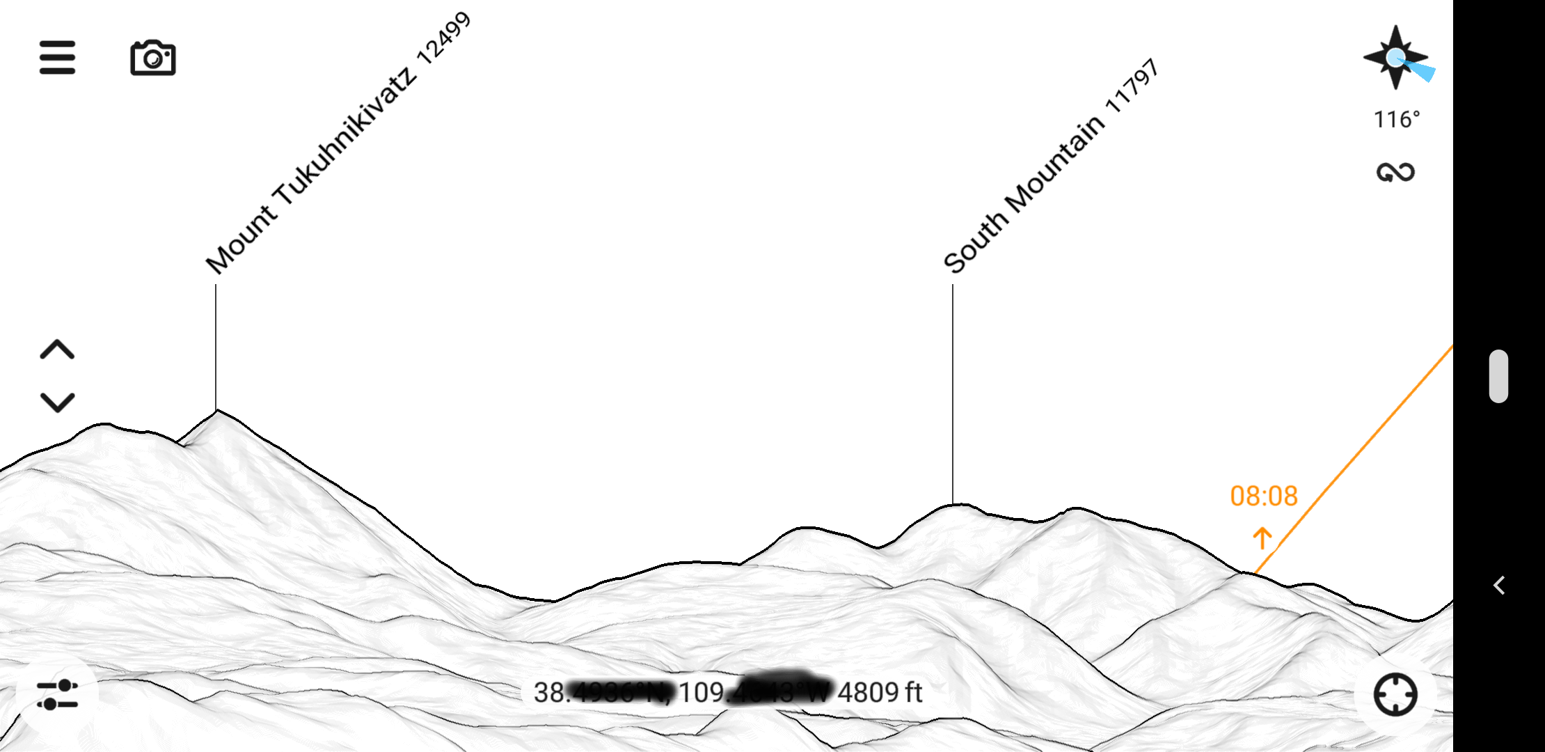
- As the name implies, Peak Finder lets a user identify peaks and other prominent natural points on the horizon. But it does more, showing such useful info as to where and when the sun might set/rise on the horizon, letting you do a flyover mode, and even matching up your camera view with the peak database. I’ve been using this app for years. The one-time fee of $5 as of this writing has been more than worth it.
- Sky Map is one I make a lot of use of in the stunning night sky of Utah. Another app that’s simple, easy to use, and free. The red light mode makes a nice touch for active night sky viewing.
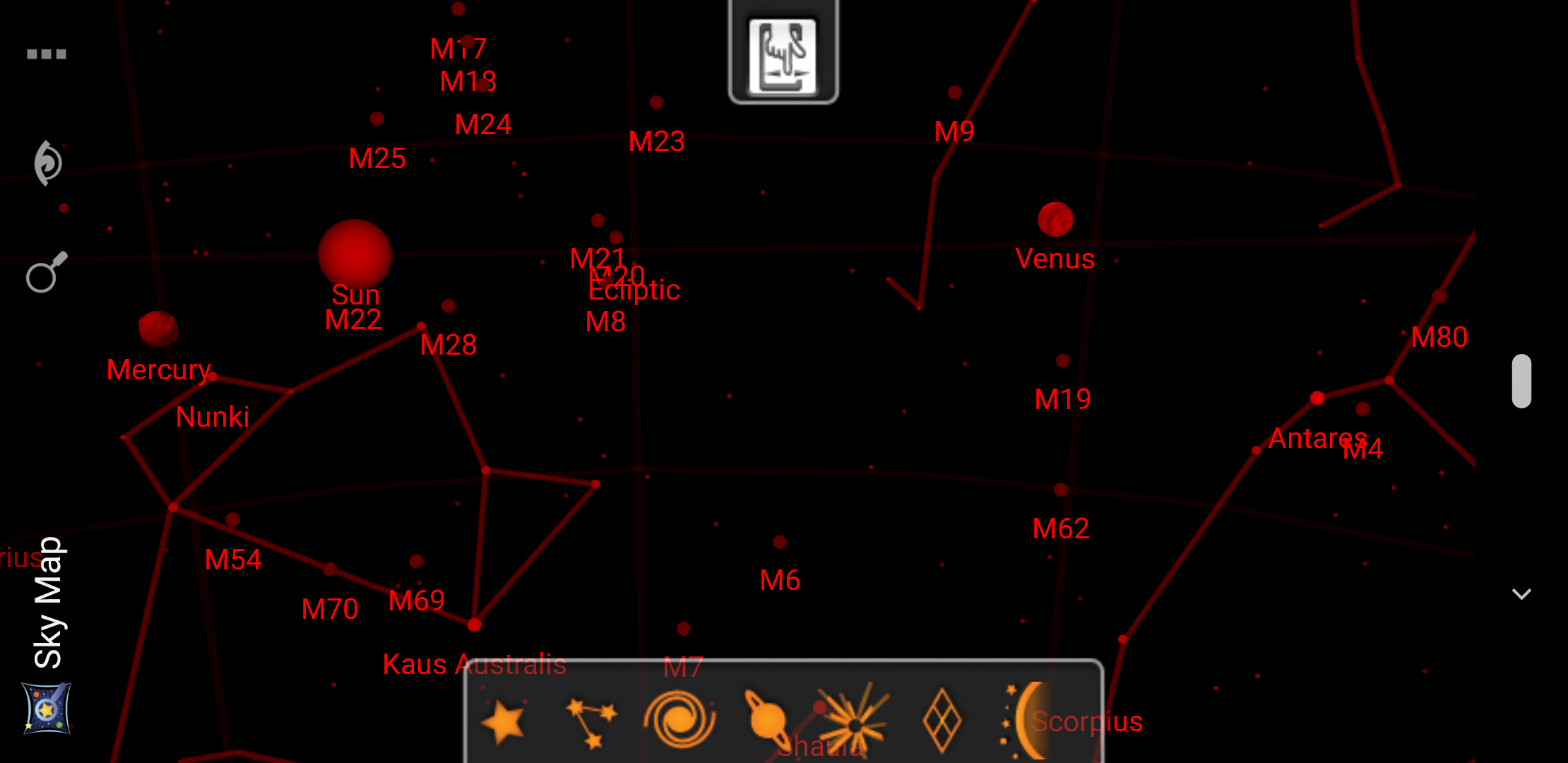
The theoretical sky with the sun out.
Don’t forget that your internal phone compass occasionally needs calibration! These apps do not work well if your compass is out of whack. Many of these apps’ complaints are from people who don’t realize that their phone case, other electronics, or magnets can cause internal compass inaccuracy.
Finally, not an outdoor app per se, but I’ve become a fan of Google Keep to make notes in the field or at home and then sync up easily among all my devices once I get online access again. This tool allows for easy collaboration as well. We’ll note future trip ideas, notes on places we’ve seen and need to research once we get home, and even our shared grocery list.
~~~
My criteria for any tool is simple: Does it add to my experience? Is it unobtrusive? Does it work without any large futzing on my part? In the case of the tools above, the answer makes a definitive YES! And I suspect that will be the case in the future.
Thanks for your list of useful apps, I’ll have to try more of them. Peak Finder is way fun.
One of my frequently-used hiking/backpacking apps is Sun Seeker (iOS & Android), which shows where the sun is in the sky, including a “3D view” that shows the sun’s path on top of your camera view. Want that perfect sunrise/sunset view between the trees from camp? Piece of cake. How long till the sun drops below that ridge? Easy-peasy.
I’m sure there are similar apps available, but the 3D view is pretty special.
THanks fro the tip! I’ll have to check that one out.