I’ve been asked how I come up with trip ideas in the past.
Nothing too radical as I’ve mentioned before.
But once I decide on a place, how do I plan out the details?
Maps of various sizes and scales of course.
But increasingly much of my pre-trip planning uses Google Maps. The satellite view in particular.
From Cartoon Stock
It is quick, has an extensive database, and I can get directions to where I am driving efficiently. I realize other tools have this ability too, often piggybacking on Google, but I just find Google Maps satellite view easier to use and share as well.
But whichever tool is used for the satellite view, I encourage this type of tool to be used. Especially if you are going to areas off the beaten path and making up some of your own routes.
Why use a satellite map view? Beyond just finding a place to go?
- Easy to scope out initial road conditions and possible parking.
When my friends and I hiked the Ferris Mountain range figuring out where to start and end the route was a major part of the planning. Aaron of TrailGroove and I collaborated by looking at the Google Satellite view. We zoomed in, and it looked OK for our 4WD vehicles (assuming it did not rain) at both “trailheads.” Used in conjunction with our backcountry road atlas of choice, we were able to find, map out, and plot our route of choice for parking and shuttling.
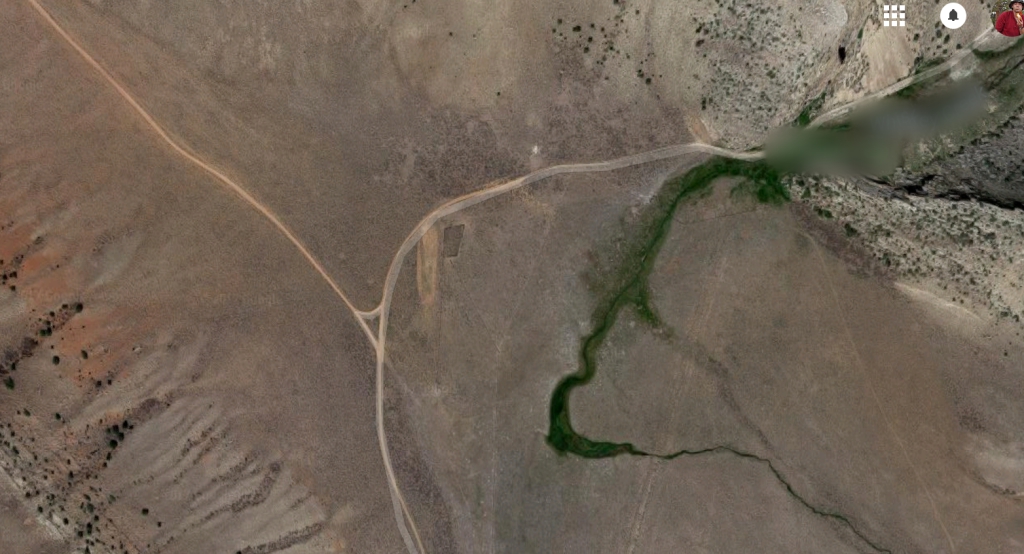
The view of the what we called our trailhead. I’ll leave in some of the mystery. 😉

And the “trailhead”!
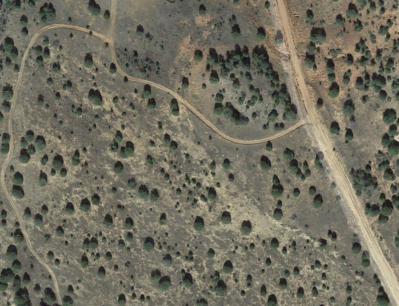
- And for those-off-the-beaten path areas, many times a more updated view is given versus old topos
Natural features do not change often. However, trails, roads, trailheads, and other human made structures often going to be in disrepair or outright gone.
The satellite view will have more recent views than what is on the older topos.
The satellite view was beneficial showing the network of jeep tracks of various quality that was the de facto set of trails in a canyon found in the Kiowa Grasslands. I was able to plan out a trip that works well. Naturally, you can often print or even download this satellite view to your mobile device, too.
 Even with good maps, a satellite view helps scope out the terrain
The topo maps show that the off-trail route looks doable. But what does the terrain looks like on the ground? Grassy? Talus and scree? Should I brush up on my Catholic school prayers?
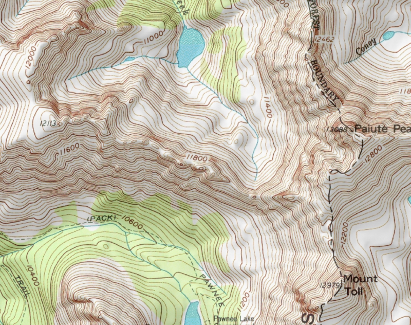
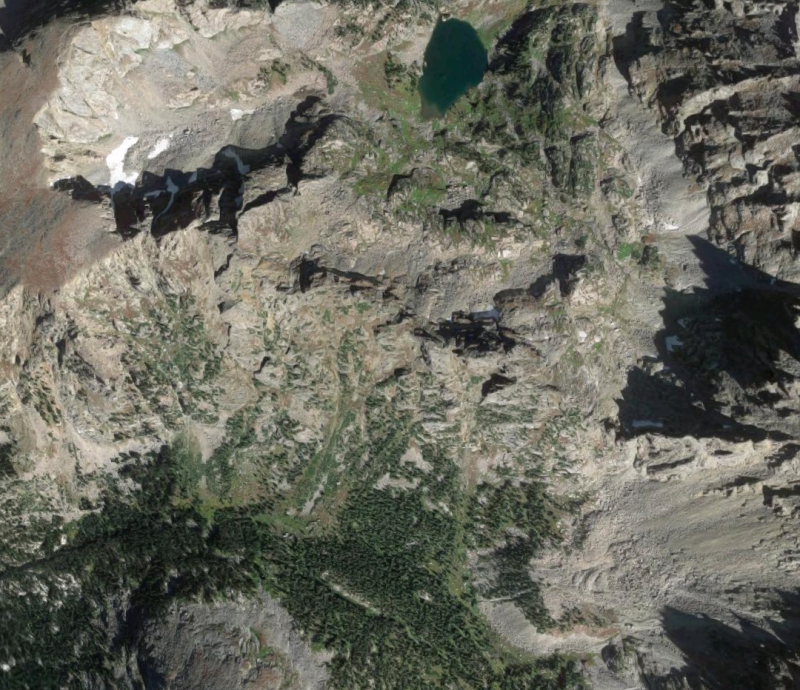
My friends and I were able to look at the map in the first photo, compare to the satellite view (zoomed in!) and feel confident of our abilities to scramble over the unnamed pass and make it down to the lake. It wasn’t easy. But it was within our ability level.
The trip was completed. And we had a bit of wildness in a heavily used Wilderness Area. And it was fantastic.
And part of the initial trip confidence was because of the satellite view.
***
The Google Maps satellite view is a handy tool to have in your trip planning tool kit. Google Maps or similar is not the only tool to use. And a person still needs the experience to translate this information and apply the info in the field correctly.
But, when you want to go to places a little more off the beaten path, consider making use of this tool. It has been useful for me. And I suspect it will continue being more and more helpful in the years to come.
I agree. I’ve been using it for planning my upcoming trip, which is going to be off trail quite a bit, and it has been very useful.
Nice explanation! We are planning a trip and this was a timely piece of knowledge.