There is a small range at the edge of the Great Divide Basin in Wyoming.
I’ve passed it many times over the years on the way to points north. And one memorable year, I hiked just to the west of it.
This obscure range is the Ferris Mountain Wilderness Study Area.
Not much is known about this range. Summit Post has no references about it. Wikipedia describes it in a couple of scant sentences. A few (virtually) dusty magazines and books found scanned in with Google books are found online. And a brief mention is found as a route for the CDT by Jim Wolf and the venerable Continental Divide Trail Society.
This unknown and obscure range has intrigued me for the better part of the decade.
What are these mountains? Are there trails? What is the terrain like?
The more I researched and the less I found, the more intrigued I became.
I wanted to see these mountains not too far away. Yet so unknown.
The only information, really, is to be found in backcountry road atlases, topos and Google satellite views.
A route was planned. My buddy Mark was gung-ho for it. Mike, a new comer to Colorado wanted to check out this obscure range as well. He and Rachel trekked in the area last year and was as intrigued as I was about it. And I extended the invitation to Aaron of TrailGroove Magazine.
At four people, a larger group than all of us were used to for a backpacking trip. But we are all capable outdoors people and I figured our personalities would mesh.
With Aaron joining us, a walk of the entire range was possible. He suggested we figure out a shuttle situation. A lightbulb went off, we looked over some of the resources mentioned above and figured out where to park the vehicles.
On paper, twenty miles in two days did not seem difficult. But with no maintained trails, a good amount of elevation gain, some bushwhacking through downed trees and talus, cross-country travel and the occasional faint jeep trail or ghost trail, it would be a challenging, intense and rewarding weekend.
It also proved what I have started to realize about WSA lands: The place was abandoned by a mine, railroad or some sort of industry in an isolated area. There is no money or political clout to make it an official Wilderness Area. The BLM essentially decided on minimal maintenance at best. Few people go there typically. You are on your own. Good luck!
What does this mean for the average backpacker? If you enjoy wildness with your wilderness, you will love it. Know how to read a map, comfortable with doing your own research and don’t expect a spoon fed experience? Then the magic of a unique area will reveal itself.
The WSA experience is often more wilderness and wildness than designated Wilderness Areas.
To apply a quote from a book I reviewed recently, a trek in a WSA is “Sometimes Easy, Sometimes Difficult, but Always Good.”
Yes. Indeed.
With the spirit of how WSAs are intended, I’ll keep the details of the what and how to a minimum. Do the research we did and a route is obvious.
A pithy way of saying all of the above is that if you intend to follow our route: “You are on your own. Good luck!” ;).
***
Mark, Mike and myself drove up from Boulder and managed to make the “trailhead” by 11PM.
Trailhead is a bit of a generous term. It really was a jeep road three miles up from the pavement at a gap and the end of the Ferris Mountains.
The night sky above was memorable. We heard burrowing owls, coyotes yipping and of course a cow serenade!
In the morning, we woke up to a view of the mountains we would hike.
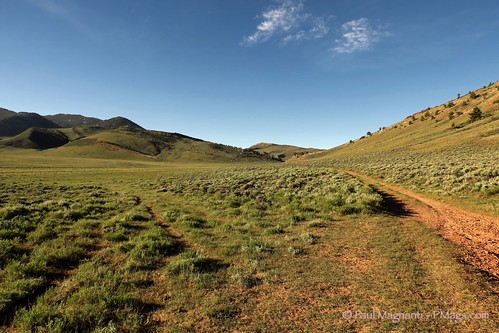
A great place to make some coffee, enjoy some oatmeal and revel in the isolation.
And to meet some locals.
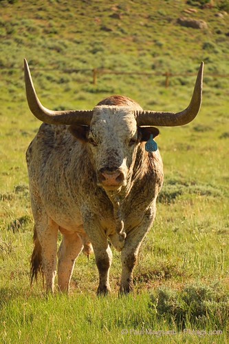
The morning was heating up fast.
By 8:30, Aaron met up with us.
The car shuttle commenced to the other end of the range.
We parked Aaron’s truck and then started up a canyon.

With all the moisture this past year, any springs and streams were flowing nicely. The wildflowers were popping.

The jeep track we were following slowly started to fade. But it did it lead up to the Ferris ridge proper.

A grassy plateau was reached.

But how best to get to the ridge just above us? Maps were consulted. A theme for the weekend.

Another faint jeep track was picked up in the direction where wanted to go.
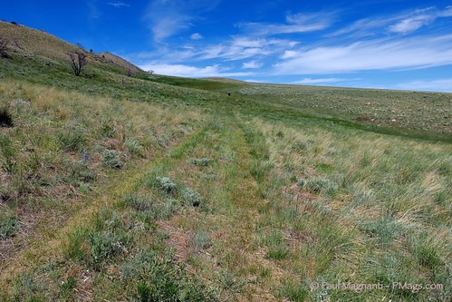
The ridge was reached.

A 2012 fire had burnt many acres on the ridge. It was warm on the ridge and only some occasional patches of snow for water. Lots of talus and “pick up sticks” blowdowns to cross. We’d manage maybe 1 MPH on the ridge itself.

The ridge walk was difficult but very rewarding. No footprints were seen. Just us, the mountains and the scenery encompassing it all.
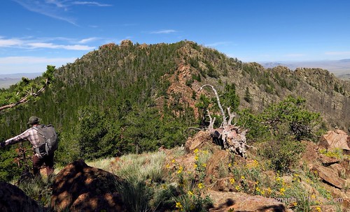
We eventually spotted the limestone fins that these mountains are known for in part.

Along the way, we spotted the remnants of a 1957 plane crash. The story behind the crash is harrowing.

We reached a saddle.
A decision had to be made.
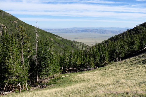
Do we climb further with the ups and downs? Or do we drop from the saddle?
A drainage was here. Water and flat terrain would be down the terrain…about 1200′ down to be precise.
But we were tired. And a lot of climbing would have to be had to the next place anywhere remotely near water if we continued along the saddle.
We made a decision.
We dropped from the saddle.
After about 400′ from the saddle, a nicely flowing seep was found. A little bit away from the seep, a reasonably flat area was found.
A good decision had been made.
Well rested, we woke up in the morning. We made our way up to the summits and bumps that made up the smaller mountains on the way to Ferris Peak.

The summit was then reached.

Looking east to where we had hiked.
The views were amazing. Seems like all of Wyoming could be seen. The Wind River Range was in the distance. Our route was ahead, too.

Good time was made on the tundra walks.

We could see our destinations below: A gap in the limestone fins and the pass beyond it.

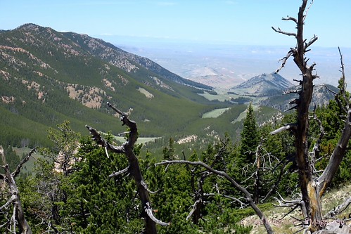
The gap in the limestone fins was the crux for the day. It was on the map. And it lead the way to easier terrain and a prominent pass.
Seeing the fins up-close was very impressive. A highlight of the trek.

Just beyond the gap, we found a “ghost trail” that meandered in and out of existence.

The pass was reached along with other grassy meadows. The fins continued to be impressive.

We continued to descend lower. Pines gave way to sagebrush. More creeks, flowing well, were found.

The last pass was crossed. We started our long descent to the end of the range and to the last drainage.

If you look closely, the road where my vehicle is parked can be seen. The very small black dot is my vehicle. Shows how long this descent went.
We reached the drainage. The western portion of the ridge was above. The decision to walk the “high meadow” route for the second day was a good choice.

We soon reached a gap where the mountains ended and where my vehicle was parked.

Looking back to the mountains, the route seemed gentle and pleasant rather than intense and challenging.
 At the end, the area was a beautiful spot to relax a bit and enjoy a cold beverage.

After a bit, we started our long shuttle.
On the way to Aaron’s truck, we had a Wyoming-style traffic jam: A dozen or so horses that had to go around us before we could continue!
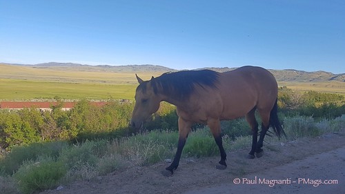
Not the best photo. But too funny to pass up horses perhaps a few feet from my vehicle.
Aaron’s truck was reached. We parted to start our drives back home. And I made it to Casa Mags at 1:30 AM.
It was all worth it.
Notes:
- The trek was roughly 20 miles. About 7000′ gain and about 7000′ loss. A few remnants of jeep roads and old trails. Otherwise all bushwhacking, scrambling or cross-country travel. A very memorable twenty miles.
- No matter what route you do, a vehicle with good ground clearance is suggested for reaching the access points.
- This route is NOT the Jim Wolf CDTS route. That CDTS route joined up with ours just below the fins and continues, more or less, where we went to our car. The CDTS route then continues along the jeep road we drove in on and then into the Great Divide Basin proper. The CDTS route does not go on the ridge.


Another excellent post.
I use the same methodology. Drive past a place that looks remote, fairly inaccessible, and deserted. Get a big map to verify the lack of trails and roads. Go hike it.
Very cool
Love it. This is, to me, the end-state of backpacking for the experienced outdoor adventurer – map a route, plan a route, do a route. Very cool
Thanks for the kind words all. It was among my most memorable backpacking weekends. I’ve planned plenty of routes just looking at maps. But never planned a route in an area as obscure as the Ferris WSA before. It was quite rewarding.
Im 66 yr’s old i been looking to do farris a long time did it in july 2016 ,,stayed for 2 days in there along pete creek and the top ,put my name in the book , going back next year to do more fell in love with ferris mt..
A wonderful range for sure!
States full go home greeny!
I live Utah. Also, you may want to do some research: Wyoming has the lowest population overall and second least population by density. If you are going to insult, at least get your insults correct and making sense. Anyway, you are writing from Idaho it looks like; get your states correct too. 😉