When I finished my across Utah walk three years ago, I followed a route just below the summits of the La Sal Mountains and ended my walk in the small hamlet of Gateway, CO.
.
.
I spent the morning walking through John Brown Canyon on the Colorado side of the border and then hitched up to Grand Junction through the geologically and visually stunning Unaweep Canyon.
.
Over the past three years, I’ve also traveled through the aptly named Paradox Valley.
.
But I wanted to see these areas a bit more.
.
This weekend Joan and I did a sampler that took in a loop on the other side of the La Sal Mountains from us.
.

.
We did two nights of camping interspersed with hiking in and along the Uncompahgre Plateau, Unaweep Canyon, and Paradox Valley.
.

.
A look at the map readily shows how the rivers, canyons, trails, and jeep tracks connect to the modern towns and highways that make up our immediate area.
.

.
Looking at the map, I plotted a future route that’s nearly all single, jeep, or ATV track to get to Grand Junction. Our current travel paths, no doubt, follow older ones.
.

.
We saw rock images, metates, and other signs of how long people traveled these areas.
.

.

.
State and county lines seem a mostly false construct compared to the land flow and how people traveled through generations ago.
.
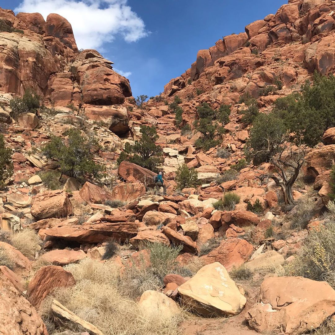
A natural break in the canyon wall by rock images, metates, and signs of ancient and modern camping. And lead to a spring. PCO Joan.
.

.
As the days grow shorter and the weather gets colder, we find these days with many “cherry-picked” hikes a useful way to explore places near us that we have not seen before so close to our home.
.

.
We’ve also found that using the truck for quick camps between hikes a utilitarian way of exploring the area. A way to see places not easily seen via backpacking due to private land or other issues
.
A storm over the La Sals in the distance. We pulled up to our home just as it started snowing.
.
And you never know what you might find…perhaps the Colorado Champion Pinon tree? ![]()
.

holy crap that’s a pinyon pine??!
Indeed! The photo does not do it justice. It is not exactly hidden, but you do have to go off-trail a little bit and use a GPS. Here’s the sign we saw off the side of the road: