…Nature, who is superior to all styles and ages, is now, with
pensive face, composing her poem Autumn, with which no work of man will
bear to be compared.–Thoreau, A WEEK ON THE CONCORD AND MERRIMACK RIVERS
A photo of Joan backpacking in the La Sals.

It’s time for another walk.
Almost every time I get ready to take a long walk, certain things seem to happen – I grow out my beard, I look at CalTopo and Gaia, do research, and the idle daydreaming becomes a reality.
Since Joan and I actively make the outdoors part of our life beyond one big chunk of time every few years, we often find much satisfaction in our local jaunts. I love where we live and the life we built for ourselves here in Utah.
But I get the itch and feel the need to connect with the landscape on foot again.
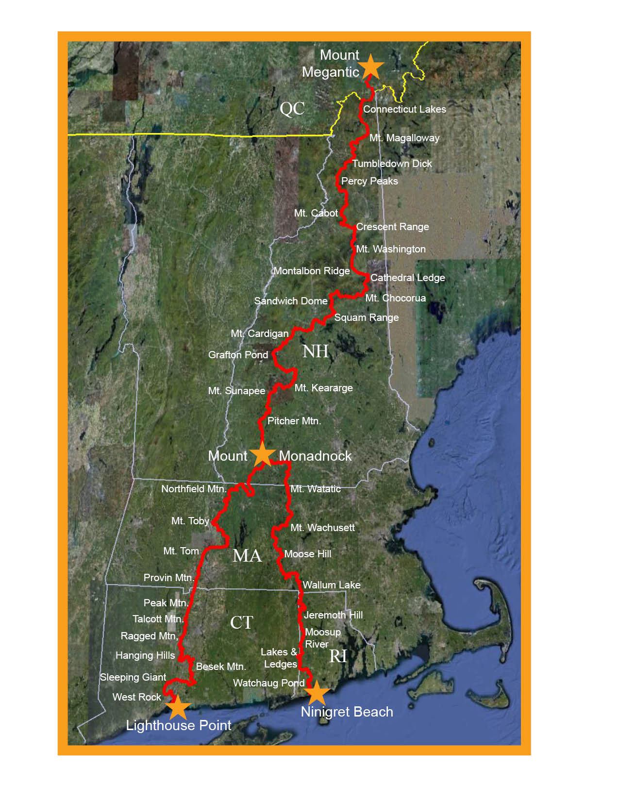
This year, I plan to embark on a 500+ mile walk through New England, when the autumn foliage is at its peak, and work my way south.
The idea of walking with autumn, starting at the Connecticut Lakes at the Canadian border and finishing on the Atlantic Ocean in my home state, has a strong appeal. About 540 miles in total. It’s always dangerous when I start daydreaming with CalTopo!
I have not been on an extended hike through New England in many years, and I want to see my native New England in all its fall glory before things change.
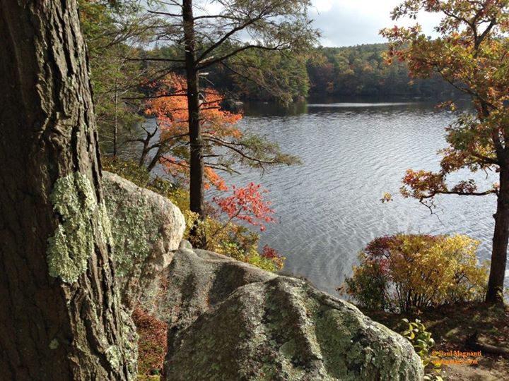
Arcadia Management Area, RI
The name of the route is A Walk Across New England—or simply, The WANE.
A nod to the waning of fall. And, more somberly, the waning of those crisp, cool, colorful days that feel fewer with each passing year.
Like my long walks through Utah in 2017 and again in 2023, tracing river and desert, and before that, rambling across the mesas, mountains, and canyons of northern New Mexico, this journey is about more than miles. It’s about connection: to landscape, to season, and to the cultural geography of a place I once called home.
Starting October 1, I’ll set out from the Canadian border in New Hampshire near the 4th Connecticut Lake, where the Connecticut River begins its journey to the sea. From there, I’ll head south through the heart of New England, finishing at the Atlantic Ocean in my home state of Rhode Island.
Along the way, I’ll retrace the footsteps of where I was introduced to the outdoors. Where I first learned to love the mountains. And where I’ll finish among the old stone walls, colonial-era farms, and salt air of the place where it began for me.
In between, I’ll pass over iconic New England peaks, wander wooded backroads and rural paths, and witness the turning of the season one step at a time.
I want to see the New England I remember—before it fades entirely. I want to walk among changing leaves. To breathe in the faint mustiness of the autumn air. To feel that crisp morning chill before it becomes more memory than reality.
I left Rhode Island more than 25 years ago to start a new life.
Now, I’m walking back into the region that shaped me, at a crossroads once again, ready to begin a new chapter.
It feels like the right time to hike through the place where it all started.

Mt. Lafayette in October of 1986. My first mountain hike. Blurry, out-of-focus, and pixelated. But I’ll take it. Notice the white blazes. Little did I know what following them would mean to me 12 years later.
The Segments
I divided the Walk Across New England into eight segments, each with its specific logistics, challenges, resources, and concerns.
In brief, the segments are:
- Cohos Trail – 170 miles
- Crawford Notch to Moosilauke (Rumney, NH) mainly via the Appalachian Trail – 68 miles
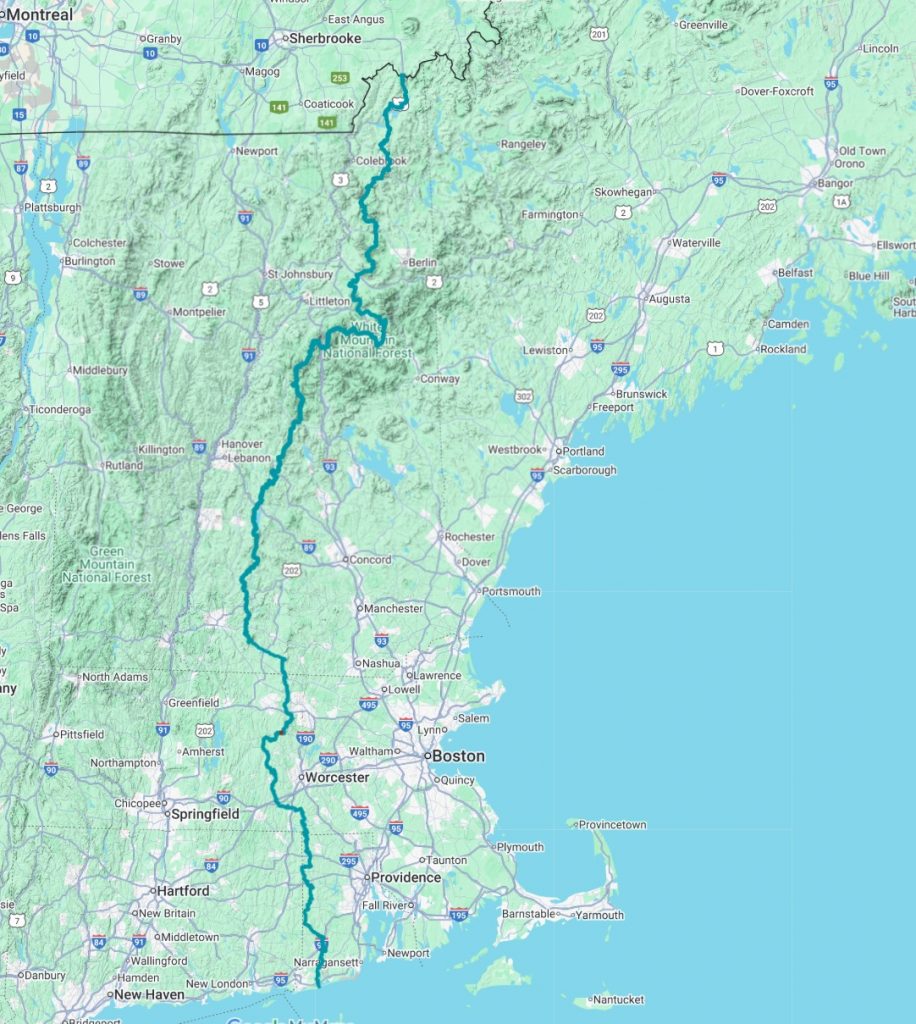
Route of The WANE: From the 4th Connecticut Lake to Narragansett Bay
- Moosilauke (Rumney, NH) to Cardigan – ~30 miles
- Cardigan to Mt. Sunapee – ~20 miles
- Monadnock-Sunapee Greenway Trail – 48 miles
- Grand Monadnock (summit) to the Wapack Trail northern terminus – 13 miles
- The Wapack and Midstate Trails – 113 miles
- North-South Trail – 78 miles
Altogether, a total of about 540 miles [1] per established mileage figures from trail orgs, map traces, and GPX datapoints. Naturally, some of these sources disagree slightly. As usual, I’ll use a mix of print maps, CalTopo, Avenza, and Gaia GPS, both for planning and in the field, with the appropriate layer(s).
[1] My apologies to those in the civilized world who don’t use Freedom UnitsTM. That’s about 870k km total.
The OpenStreetMap layer on CalTopo proved to be rather helpful, as it includes southern New Hampshire trails, as well as the Wapack, Midstate, and North-South trail systems. A pleasant surprise! The road walking portions work well with this layer, of course. These maps are clear, uncluttered, and easy to read.
For resupply, I’ll be “buying as I go” and not using maildrop except for a “shoe drop” in Grafton, NH, about halfway through. I’ve learned that for a couple of days at a time, I can make do with most gas stations and convenience store-type supplies. I’ll buy real (and better!) food in the larger towns along the way.
I plan to take just under a month in total to hike this distance.
The segments in more detail? Read more below!
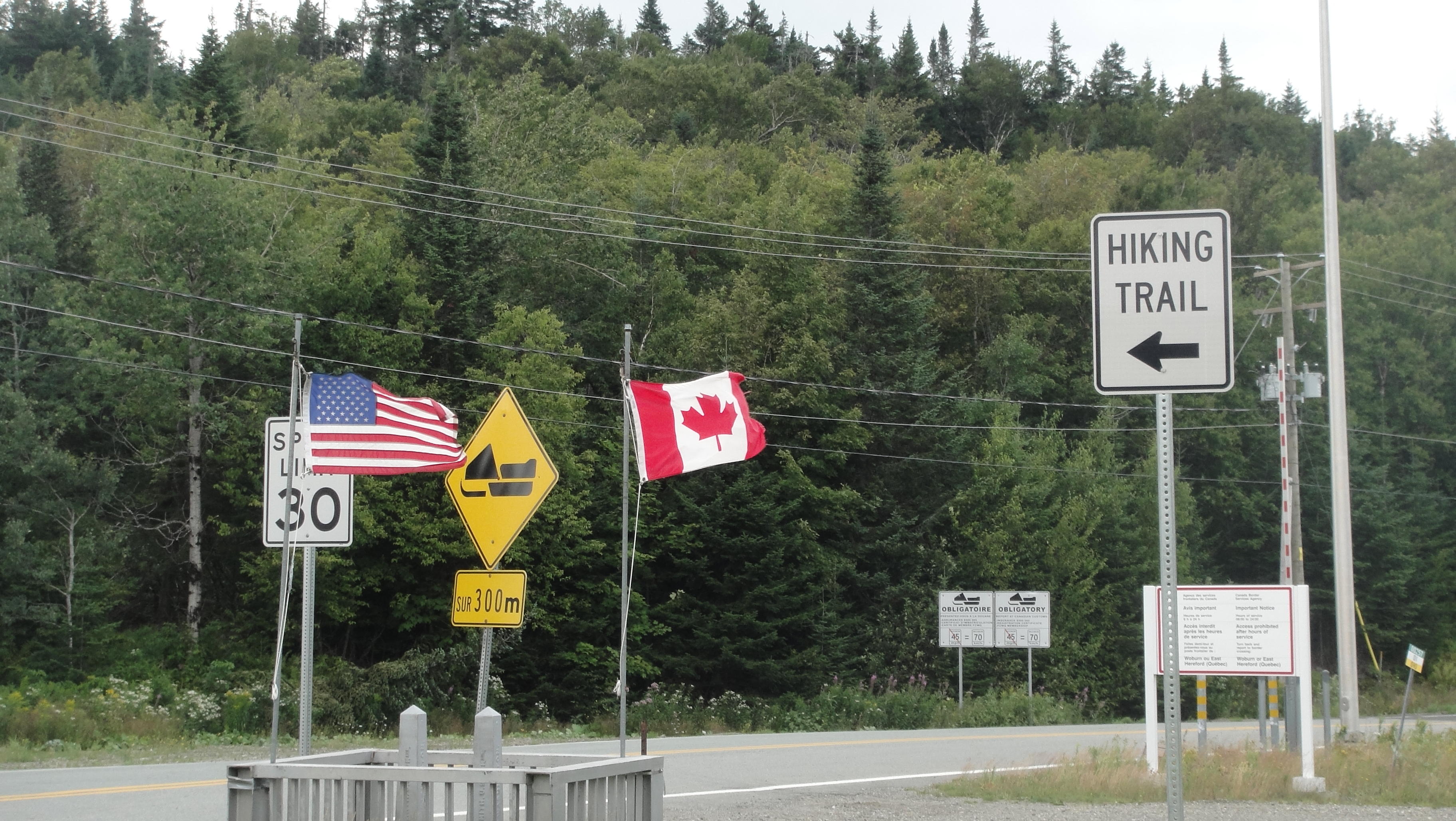
Canadian Border near 4th Connecticut Lake and the start of the Cohos Trail. From The Park Explorer.
-
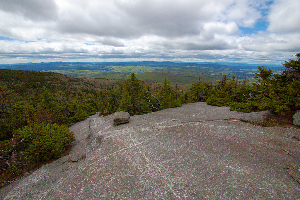
The Cohos Trail – 170 miles

On the Cohos Trail overlooking Pondicherry Pond. From TripAdvisor.
At 170 miles, the Cohos Trail is the longest continuous stretch of my walk. Taking in some of the more remote terrain in the Northeast, I’ve been eyeing this trail for a while now. Backpacking this trail by itself would make an exquisite vacation thru-hike if you dial in your transportation.
- The Cohos Trail website is the first place to get information
- For maps, I’ll be using the Cohos Trail map pack in addition to GPX waypoints I’ve found online. Avenza also has a Cohos-specific map set I’ll use.
- Resupply is straightforward with on-trail resupply at Jefferson, Pittsburg, and Bretton Woods.
- The main challenges are weather-dependent. I could discover glorious New England Fall weather. Or nasty snowy conditions!
-
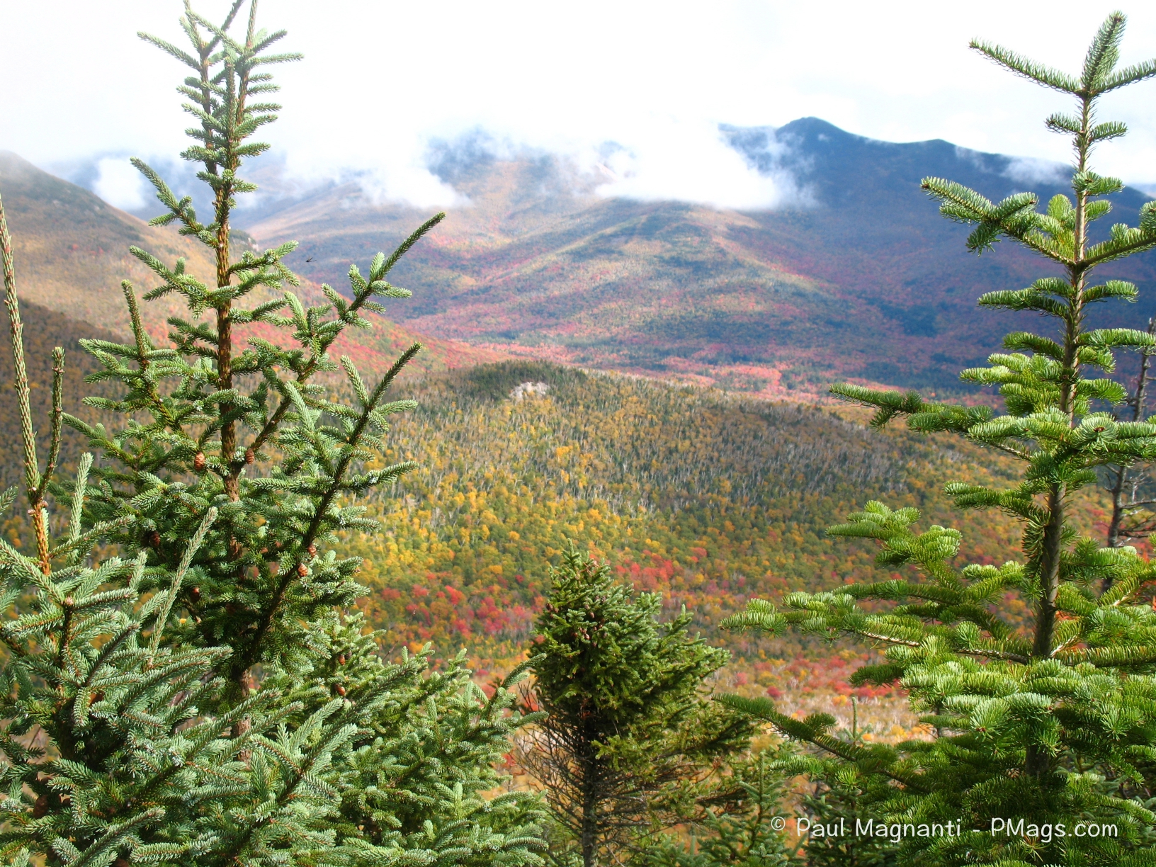
The Appalachian Trail from Crawford Notch to Moosilauke – 68 miles
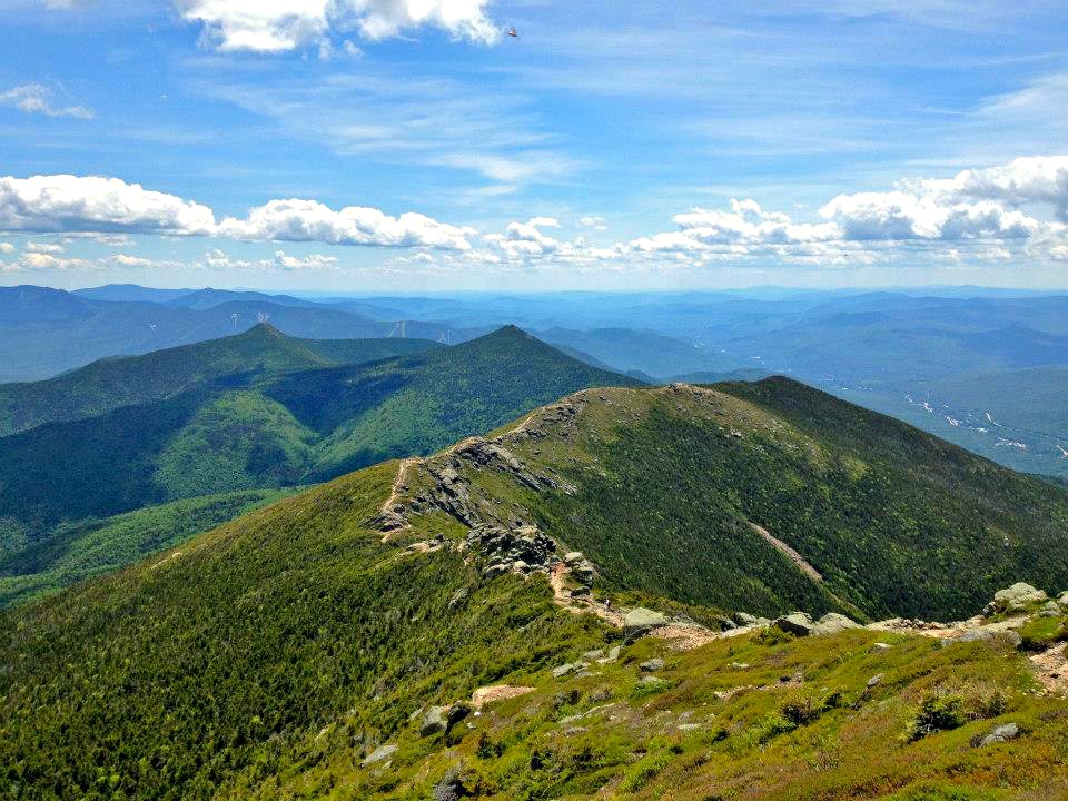
The famous Franconia Ridge on the Appalachian Trail. From “The New England Project”.
At about 70 miles, this section is potentially the scenic highlight of the trip. This area is where I began my formative backpacking experiences. And a place where I always love to visit again. I don’t think any person will ever get tired of hiking along Franconia Ridge. Especially if the weather cooperates! Moosilaukee seems to be an appropriate place to end this section, essentially.
- I’ll be taking the Map Adventure: White Mountains map for two simple reasons: I already own it, and it happens to cover this stretch of trail adequately.
- As with the Cohos Trail section, the major challenge is weather-dependent. But even more so, as I’ll be in some of the more exposed areas of the Appalachian Trail. Luckily, there are bailout points if needed
- I don’t plan on resupplying on this stretch. I’ll stock up at the end of the Cohos Trail and then resupply in the small store in Rumney, NH, (or hitch to nearby Plymouth) at the end of this segment.
-
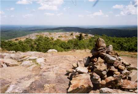
Moosilauke to Cardigan – 30 miles
View from Mt. Cardigan. From Wikipedia.
This section involves approximately 30 miles of walking on old stage roads, single-track trails, backcountry roads, and snowmobile tracks, culminating at the iconic New England Peak of Mt. Cardigan. Although the route is not a traditional trail, it is rural and short enough that I shouldn’t get too tired of walking it.
- I’ll be using custom maps made with CalTopo.
- I’ll do a small resupply in the Rumney store or hitch to nearby Plymouth. Worst case, there’s a brewery nearby!
- I hope to time my hiking to make one large push from the public land just around Stinson Lake and reach Mt. Cardigan, where camping is available.
- I may even stay at a local hostel and then hike, depending on my needs for a shower and laundry!
- I suspect the Mt. Cardigan lodge won’t meet my needs or budget, but I’ll check it out!
-
Cardigan to Sunapee – 22 miles
Mt. Sunapee. From “The Friends of the Sunapee Trail”.
- Similar to the above segment, but about 22 miles.
- Depending on my timing at Cardigan, I could take a day’s walk on public land, if that option makes sense for where I’m at on my route.
- More pavement walking, but more accessible opportunities for a resupply and a shower. A quick hitch or even hike to New London in particular, if needed. Lodging will be expensive during the New England fall (!), so it will probably be an in-and-out visit, esp with the relatively short mileage between the two segments.
- I’ll be using custom CalTopo maps for this segment as well.
-
Monadnock-Sunapee Greenway Trail – 48 miles

1996, Mt. Monadnock – Cotton t-shirt, leather boots, and a full head of hair! The first year I started hiking in earnest. I went on a first, mistake-prone, backpacking trip over Memorial Day weekend a few weeks earlier.
Back on a designated trail! The Monadnock to Sunapee Greenway Trail (or should it be Sunapee to Monadnock Greenway for me?) is just under 50 miles of mainly gentle and rural New England walking. I’ll be exploring a part of New Hampshire that I am not overly familiar with, either. The bookends are, again, two iconic New England summits: Sunapee and Monadnock.
- The Monadnock-Sunapee Greenway Trail Club website is an excellent first stop for information.
- The Trek’s article on this trail is also helpful
- Again, using CalTopo-generated print maps
- At Sunapee, I can resupply, and there is a general store about halfway through this section. Light food carry!
-
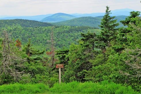
Monadnock to Wapack Trail northern terminus – 13 miles
Pack Monadnock at the northern terminus of the Wapack Trail. From Trail Finder.
The shortest segment of 13 miles total. About two miles of trails and eleven miles of road walking.
- A connector section, to be honest, but an easy resupply in Jaffrey, NH, that will carry me through the next few days.
- From the summit of Monadnock, I’ll be making my way south and east to the Atlantic Ocean at the shore of my native Rhode Island.
-
Wapack Trail and Midstate Trail – 113 miles
On Mt. Wataic. Southern terminus of the Wapack Trail and the northern terminus of the Midstate Trail. From Wikipedia.
This segment is approximately 113 miles in total and comprises two separate trails: the 21-mile-long Wapack Trail and the Midstate Trail, which will take me over 90 miles to the Rhode Island border. I combined these two trails into one segment because the paths connect, and the resources for these trails overlap as well.
- Pack Monadnock, Watatic, and the ski area of Wachusett are some of the more well-known landmarks on this route.
- I’ll be using CalTopo maps and GPX points created from information found on the Midstate Trail website.
- I found a free “self-guided hike” doc that should be of use, too
- The succinct A Thru-Hiker’s Guide to The Massachusetts Midstate Trail is beneficial. (I have a 2016 version of it, and it is no longer available)
- An Irving and Dunkies ” is just off the trail north of Wachusett at about 30 miles into this segment, and I’ll be going through Oxford, MA at about mile 96 of this segment for the last bit of supplies to take me into RI.
-
North-South Trail – 78 miles
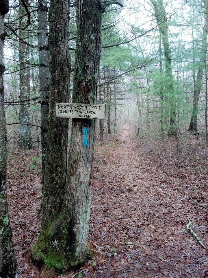
The North-South Trail at the RI/Mass border. From The NST Facebook page.
Rhode Island’s North-South Trail (NST) is 78 miles from the Mass/RI border at Douglas Forest State Park and ends at Blue Shutters Beach on the Atlantic Coast.
This trail will not be a wilderness experience, and there is a fair amount of road (Rhode??! HA!) walking. Online accounts indicate a distribution of approximately one-third paved road walking, one-third fire or old rail bed, and one-third single track. Most of the paved road walking tends to take place in rural areas and should not be too onerous.
In many ways, finding resources for this hike proved to be the most challenging of the other segments. Sometime during 2018, the AMC Narragansett Chapter migrated off their self-hosted site and no longer has the NST files previously available. There is no official NST organization active online. But some generous people helped me out by making various resources available from their archives.
- The North-South Trail Council maintains the trail on some level, but I could not find an online presence.
- The closest thing to an active organization page is found on the Rhode Island North-South Trail Resources Facebook page. The page features a downloadable map set.
- Thanks to “S Dizzy” for making his old GPX tracks of the NST segments available for downloading.
- I found the Trails and Walks on the RI NST page useful and informative. As an FYI, I suggest this site if you find guidebooks useful, as the NST guidebook is long out of print.
- The curator of the website above also provides excellent information about hiking in RI.
- In fact, the curator directed me to the beneficial Rhode Island GIS site, which contains the NST GPX data. Using this data, both the GPX points are loaded on my phone, and I can print maps via CalTopo. Thanks!
- The Trek’s NST article makes for an informative read when planning.
- Legal camping is difficult for the southern two-thirds of the trail. However, the trail is near many of my friends and family. If I am nice and buy beer, I can see day hiking one or even two days on this trail. 🙂
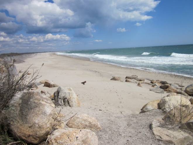
Blue Shutters Beach is on the Atlantic Ocean and the end of the NST. From the Providence Journal.
This route sounds suspiciously like the old New England Trail?!?
.
The New England Trail is a concept floated out in the early 2000s that never entirely came to fruition. I vaguely recalled the trail concept, but I couldn’t find any mention of it until after I had planned out my route. Some Wayback Machine sleuthing revealed a circa 2012 website that provided a high-level overview of the route, although many maps and other details were missing.
The old New England Trail map. Via the Wayback Machine
My initial research recreated The East Branch of this route in many ways! The New England National Scenic Trail is essentially The West Branch of this proposed route. The major split of the two historic branches is at Grand Monadnock.
The North Branch (essentially, most of New Hampshire) of this old route is considerably more circuitous than my route through the White Mountains before it makes its way to Cardigan. I’ll be taking a direct line from the end of the Cohos Trail to Moosilauke via the AT and then on to Cardigan instead.
At this point, the old New England Trail is a largely forgotten concept, and the New England National Scenic Trail and the New England Trail are the same for all purposes.
Why not connect to the New England National Scenic Trail instead?
When I reach Monadnock, I could take the Metacomet-Monadnock Trail to connect with the New England National Scenic Trail, following it to the Connecticut coast. But the answer is simple: I’m a Rhode Island native, not a Connecticut one.
I want to end at the ocean of my childhood—with clamcakes, chowder, and a stuffie on the side, washed down with a Del’s lemonade.
Regardless of the politics, gotta love the (in)famous Calamari Ninja from when my home state shilled seafood!
Mileage-wise, the route I am taking from Monadnock to the RI coast is almost the same as following the M&M trail system to the NET and on to the ocean. Though hiking a National Scenic Trail has some allure, hiking through the woods and rural areas of my home state is more compelling. While the North-South Trail in RI probably has more road walking overall compared to the CT portion of the New England Trail, I am familiar with those roads in RI, and I also know they are mainly rural walks.
Considering my friends and family are close by, it is a no-brainer to head east and then south through Rhode Island rather than west and then south through Connecticut.
If you want to read about what a Western Branch of a New England trek would be like, I suggest looking at the following journals, articles, or Instagram accounts:
- Brian Tanzman, aka “Buck-30” hiked the New England National Scenic Trail to Monadnock in the summer of 2018.
- Ryan Linn of Guthook fame did a hike very similar to mine back in 2009 up to Monadnock. His route explored more of the Whites than I intended. He also documented the journey a bit on Backpacking Light.
- Griggs Domler also did a New England Trail, West Branch-type hike in 2018. His route took the Appalachian Trail to Hanover and then on to Mt. Sunapee. My route will take me to Moosilaukee, then to Cardigan, and finally to Sunapee.
I could not find any accounts of people who went from the Monadnock to the Atlantic via the Midstate Trail and the North-South Trail as a continuous hike. I am sure there are others, though!
Edit: Turns out Andreas Frese had already done plenty of Brett-Tucker-style scouting and mapped many of the routes while I reinvented the wheel. Ha!
Thanks for the last-minute intel, Andreas—especially the Jewell Hill section. Check out his excellent site for more info.
Gear
My gear list is more or less here.
It has not undergone significant changes since 2019, when I last updated it before this trip. Still, I’ve tweaked it over the years with the addition of a sun hoodie instead of a more traditional base layer, I use a buff, don’t take a beanie, and use the no longer made Montane Allez Hoodie.
Perhaps I should update it more, but I view gear as tools in a kit, and I rarely repeat the same type of trip back-to-back. I’m also lazy.
As I mentioned in my last update, the total base pack weight ranges from 8 lbs (3.6 kg) for a very minimal three-season kit without my camera, all the way up to 15 lbs (6.8 kg) for colder weather trips with Joan.

A trip to the Abajos this past year. Kind sorta looks like NH??? From Joan.
Some specific notes and modifcations for this trip:
I expect colder, wetter conditions in a New England October compared to the Colorado Plateau, so I’ll be adjusting my gear accordingly. Naturally, my water and food carries will be a bit lighter than what I’m used to out West!
- I am exclusively using my Pixel 8A for photography. It takes good photos; I don’t need to use an optical zoom, as I do with many of the archaeological sites Joan and I tend to hike near. The potentially wet conditions pose too significant a risk of damage to a traditional camera, even to a weather-resistant one. Bonus: I’ll save weight.
- As with my trip to Utah, which I also took in the Fall, but further south in latitude, I’ll take an alcohol stove for dinner and a hot drink. I found a meal and a hot drink (and a book loaded on my phone) to be beneficial during the long(ish) nights. Cool and wet New England weather makes an excellent use case for this stove.
- I’ll also be taking a Montbell Trekker rain jacket and pants due to the potential colder and wetter weather in the White Mountains in October.
- I plan to wear a Squak Swell Hoodie as I think it will be a suitable piece for a New England autumn. I will not take my traditional button-up.
- Speaking of Squak, as I will be pushing into the later fall, especially in the Whites, I plan on taking the grid fleece hoodie.
- For similar reasons, I am packing a simple pair of fleece mittens.
- And I’ll take my hiking ball cap of choice versus a wide-brimmed hat as well.
- Finally, due to the potential wet and cold conditions found in New England compared to the Intermountain West, I plan to swap out my down jacket for a hooded Montbell UL Thermawrap Parka.
- And tis the blaze orange and pink hiking season, too!
- Essentially, by removing the camera and adding the above colder-weather gear and clothing, I am at approximately the 12 lb mark (or 5.4 kg for those in the civilized world).
- I don’t weigh my gear too closely at this point TBH!
- UPDATE – Using an angler’s scale, I weighed my packed gear. That’s including a battery I use for longer trips, blaze orange accessories, both a new pack and tent I am testing, and the colder and wet weather clothing. Altogether weighs a smidge under 12lbs / 5.5 kg, indeed. Ha!
Misc
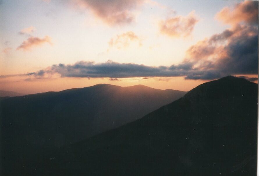
Along Franconia Ridge in the Fall of 2008.
I suspect I’ll do sporadic updates with overall thoughts when I finish my trip.
Overall, I think this planned route will be an excellent way to see New England during the fall!
One of my first solo backpacks was way back in the Fall of 1996. Between Mt. Flume and Mt. Liberty
As always, many thanks to several people…
- Thanks to the many trail orgs up and down the route for the excellent work they do! Whether it’s a remote part of New Hampshire, rural lands outside of Boston, or pleasant walks in Rhode Island, accessible land and trails enhance the overall quality of life. The many volunteers who devote their time to maintaining these public paths are amazing.
- The hiking community, especially on various Facebook groups and websites, has made its knowledge available and answered some questions. Thank you!
- “LarryBoy,” who nudged me into calling this route “A Walk Across New England.” I hesitated to call this hike a walk across New England, since it doesn’t include Maine. However, he pointed out to me that the New England National Scenic Trail only encompasses two of the New England states, and I’m walking across three (and briefly dipping into Connecticut, to boot). Good point! Appropriately enough, we are attending his and Stephanie’s wedding just before I take off on the trip as well!
- My many friends and family in my community for supporting me over the years
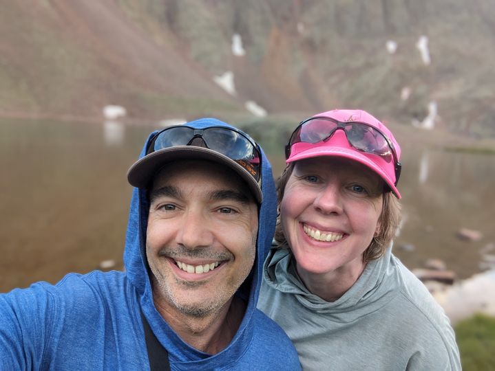
- And of course to Joan. My Utah walk in the Fall of 2017 brought me to her doorstep in Moab. And I am forever grateful for her support of me over the years.
…and now a little something I found when I first moved to Moab
ALL THE POSTS –
Looks like quite the adventure! I have not spent much time in New England, but I bet it will be beautiful! Thanks, as always, for sharing your hard work.
This looks like a great adventure.
Is there going to be any way to track your progress? I live not far from the Midstate Trail in Central MA and would love to come out to say hi or even walk with you for a bit.
Just FYI, the northern half of the Midstate is much nicer than the southern half, which has significant stretches of (paved) road walking. Also, we’re already dropping leaves in central MA so this might be an early fall.
I’ll be on instagram for more updates @PMagsco and try to write some quick posts here. When I get into southern NH, Ican write for sure. Thank you!
Yeah, with the drought this year, I was afraid of that. But, well, Ma Nature ultimately calls the shots. Should still be nice, though!
Gonna be following big time. This sounds great. A kinda miss the East quite often also.
Looking forward to the tales from your adventure!
Approximately, how many grams (+ – 0.1g) does your beard add, and is that weight calculated into your TPW?
Looks like such a cool journey, man! Enjoy your walk.
Ha! Thanks for the good wishes.
Change of colors, change of chapters………have a fantastic journey!
Thank you, my friend!!! The drought in New England is causing Ma Nature’s schedule to go off this year it seems. ;( I’m sure it will be glorious, though!
I’m looking forward to this. I’ve through hiked the Cohos Trail and section hiked the North-South Trail, and done some of the trails in between. I live in eastern Conn., so if you need a ride somewhere while you’re in R.I. I might be able to help you out.
Thank you! Much obliged!