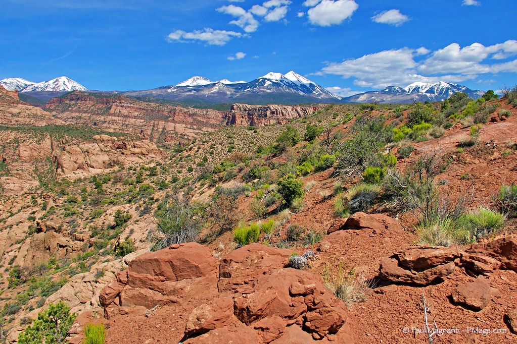
If you step out of our door and look southeast, you see you the compact range of the La Sal mountains. Two passes bisect the range and contain nearly a dozen 12,000 ft peaks with Mt. Peale the highest at just shy of 13,000 ft.

Sept 2018 on the summit of Mt. Peale
Looking from the high desert floor of our home up these mountains, mere miles away, provides a dramatic view. And one I never find myself not enjoying. Even on daily mailbox walks.
The mountains give a respite from the heat and, other than the well-known “Whole Enchilada” mountain bike route and some nearby camping, the mountains are more a locals’ destination—a place to camp, hike, fish, snowmobile, and some ATVing. And I can even get in some skiing during the winter. And, arguably, these mountains make the Moab area even more striking by providing an exquisite mountain backdrop.
Home ain’t so bad.
I am thankful for these local mountains. And always enjoy exploring them.
A hike my friend Kevin made me aware of is a traverse of the ridge of the La Sals that takes in all the 12k peaks and walk the top of southeast Utah. This route is a known trail run. Other than one short Class 3 stretch along the way, these mountains are benign and generally rounded. We’d backpack the route instead, of course.

From a trip Joan and I did in 2018.
Alas, a planned hike in the fall of 2019, did not occur due to weather. But the idea percolated in my mind the past few months.
This past weekend seemed a good time to attempt the route slightly longer with one more peak. For logistic reasons, I’d go north to south with Joan and I hiking in together Friday evening and having a car waiting for me a mere eight miles from home. I’d walk up to the first major summit of La Sal Peak at 12001,’ and I’d also climb the last major summit of the La Sals at the appropriately named South Mountain. The total mileage of a moderate 30 miles, but with nearly 16k’ gain. A stiff, but doable, weekend backpack.
I’d hike the route solo, but Joan did join me for the first few miles on Friday as we climbed up near the shoulder of La Sal Peak.

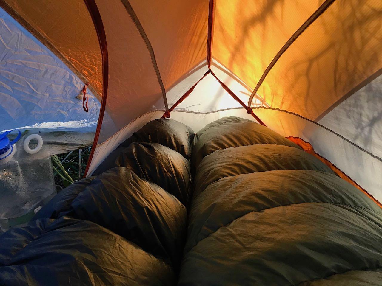
We brought solo shelters, but somehow we managed to cram into her one-person tent when it sprinkled that evening. I’ll let the reader guess which side of the bed I used. 😉
Sunrise photo from Joan.
The following morning we hiked together a little bit, and then I turned up a drainage to get to the summit of La Sal Peak and start the solo portion of my trek.
Not far from the summit, the weather turned extremely windy. I had trouble standing up. Though I found the views stupendous with the desert floor below, I could not savor them.

I soon reached the true summit, hunkered down, and could not help but notice the clouds building up ahead.

I could easily make out the route. But I’d have to attempt at another time. I stumbled down the talus while continuously blown by the wind. I had to sit down a few times! Once I dipped below treeline, the hike changed. Though I saw dark clouds above where I’d be hiking, the trees cut the wind. And I could enjoy the walk.

Not long after I made it to the safety of the trees, graupel came down, and I could hear thunder above me. I made a wise decision to stay lower!
Even at 10k ft or so, I found my route satisfying. What’s not to like when backpacking in a quiet forest I have to myself?
I’d pass old miner cabins and other remnants of the days still apparent with names such as “Miners Basin,” “Gold Knob,” and “Bachelors Basin.”
My solo reverie ended as I made it to some well-known lakes popular with campers hoping to mountain bike nearby. But the small mountain reservoirs remained nearly empty of use in the early evening hours.

After twelve hours of near-continuous hiking, I came to a quiet lake I had to myself. And a place to make camp that evening.

I could easily be camping back in Colorado. The red desert seemed remote in the cool mountain air.
The stars came out, the wind calmed down, and I must confess I became myopic in my quest. Looking over the comprehensive and large, but not detailed, overview map, I failed to notice a direct trail route back to the car on the other side of my map and zoned in on a more meandering way. A path that leads me to areas I wanted to explore more and still giving me a chance to get up to South Mountain if the weather did not turn again. Excellent for taking in the scenery if delaying my important Sunday post-hike beer quite a bit!
The morning did start calm and crisp, and I took in a meadow I last saw while skiing. A bit different in the lush summer.

I then reached a part of the mountains I’ve not seen before with open meadows, mountains above, desert below, and dotted with small tarns.


The wind did pick up again as I stayed in the relative calm of the trees and not hike South Mountain. But I could not complain about the scenery.
Some ups and down through the wooded terrain along the South Mountain, I reached my exit point back to the car. I could see my town below. And make out my neighborhood at the south end of town, too.

Technically a trail, it looks like the recent torrential rains made this already rough trail an even more eroded mess. A mess in which I gingerly walked down on the remnants of the steep sorta-switchbacks.
Soon I made it to the road where my car awaited a mile or so away. But before I walked into the evening light, I had to admire the canyon and the mountains above one last time this weekend.

I did not make quite the traverse planned, but still had a fantastic solo trip. Joan’s my favorite trip partner by far. And I enjoy our walks together. But every so often, I still have the solo hiking itch to scratch. And the La Sal trip scratched that itch!
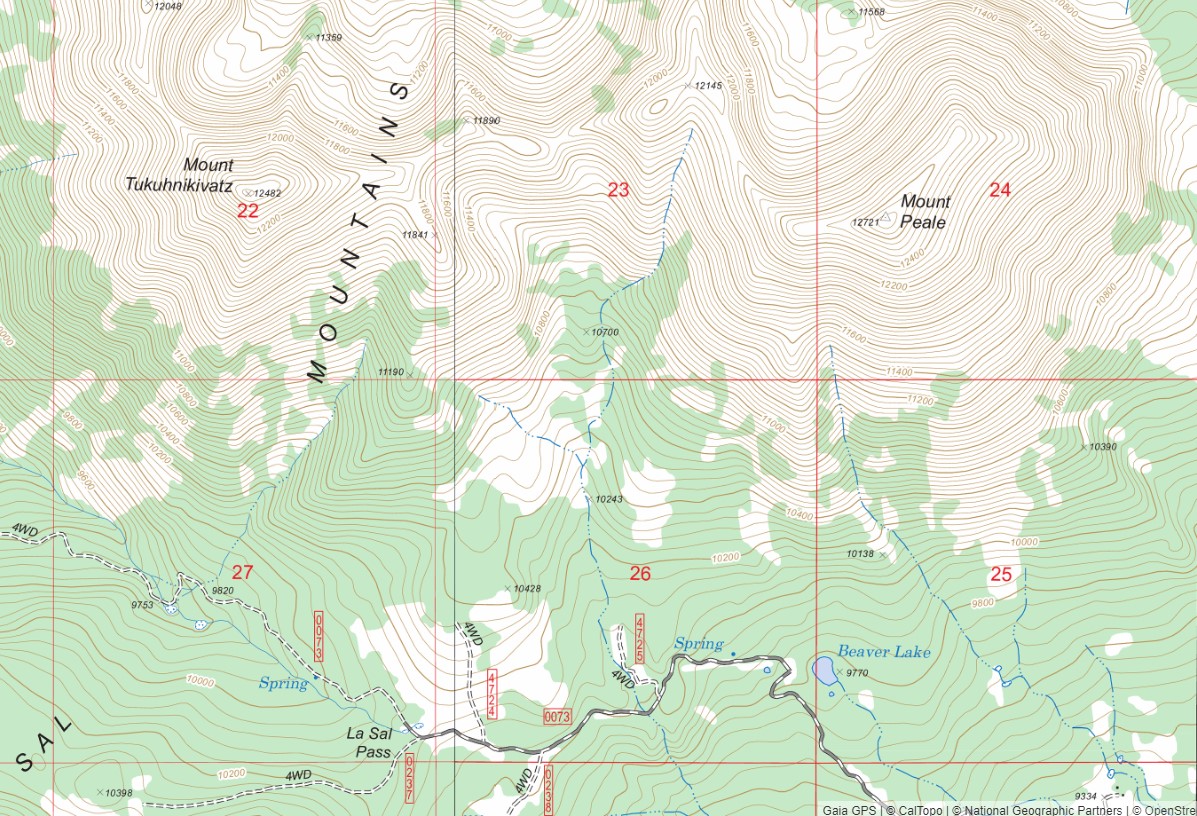
Do you want to plan a La Sal trip? There is no one complete map resource for this trip or similar.
- For driving and scoping out trailheads, the Utah Benchmark Atlas proves valuable. Some trailheads need a true 4WD vehicle and the skill to use it.
- The Latitude 40 Map Moab-East, 6th Edition, provides the most comprehensive and updated map for this area. But, it is hard to read at times (the dogleg trails for crucial trail junctions is less than 1/8 of an inch in some cases, for example), and at a 1:75,000 scale, it does not provide enough detail for off-trail travel. It’s an excellent map, just have to use it in the correct manner primarily as an overview map.
- For more detailed navigation, I use map layers accessible through Gaia GPS. The other sources are incomplete with newer trails not there, older roads that are trails now, etc—but still needed. The USGS CalTopo layer offers the most details for off-trail travel, and I also find the USFS 2016 layer handy being easy to read with some newer information not found in the USGS layer (but not as comprehensive as the Lat 40 paper map). I sometimes consult the NatGeo TI layer for the La Sals, but I never bring the print map into the field. I don’t think anyone ground-truthed these maps in a while as the road alignments are sometimes off. And many of the established trails are entirely missing. I think of the NatGeo La Sal maps as a step above the basic NPS park brochure maps meant for high-level overview and not any type of comprehensive navigation.