An overnight backpacking trip to Comanche Peak Wilderness and northern Rocky Mountain National Park
The Mummy Range is my favorite range of mountains in Rocky Mountain National Park. Remote feeling, aesthetically pleasing, wonderful for off-trail hiking and a little of the beaten path vs other parts of the park and nearby areas.
I had to work the 5th of July,so I decided to do a quick overnighter and explore the very northern part of this range via the Comanche Peak Wilderness near Pingree Park.
My original plan was to hike up to Stormy Peaks Pass, hike along the ridge to Comanche Peak and then down to some lakes and back to the car.
Alas, the (possible) weather changed the route but it was still a very satisfying backpacking trip.
The morning started a little later than intended as well. But sometimes enjoy a relaxing morning with your someone, talking and drinking coffee is sometimes even more important than backpacking. 😉
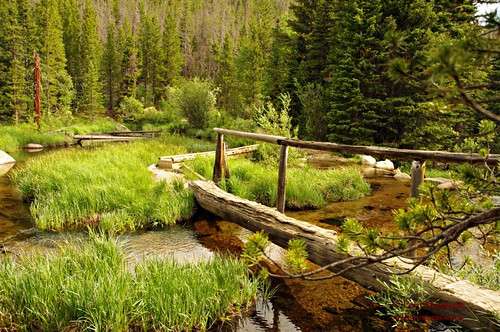
So up to Pingree Park I drove and started my trip at the rather late hour of noon.
I powered up the trail in an attempt to make up for some time. I quickly gained elevation and had a great view of Pingree Park itself.
From my vantage point, I could see why this area was desirable for the native tribes, fur trappers , pioneers and now a scenic college campus.

I quickly passed the wilderness boundary and made my way to Stormy Peaks Pass in Rocky Mountain National Park.

At the pass, I noticed the weather moving in. Not wishing to be caught above treeline in a thunder storm, I altered my route to stay on trail and go lower.

After a bit, I reached the end of the trail at Lost Lake. It was now 5:30 PM and I had to hustle if I wanted to be back in wilderness land (and legally camp) by dusk.
But at this point is where the fun began. I had to get around Icefield Pass via a very steep climb that was mainly class two hiking with a small amount of class three scrambling.

The geek in me could not help but think of The Wall from A Song of Ice And Fire (aka Game of Thrones on HBO) 🙂
Near the top of my climb, I was enjoying the view to the lakes below and the flanks of the mountains.

At the top of the climb itself, the mountains looked rather grand.


I pressed on. Just past Skull Point, I could see Mummy Pass in the distance. Once I reached this point, trail would be reached and the journey would be considerably easier.
I took the more direct route, subjecting myself to willow bashing and very wet bogs. Looking back, perhaps I should have climbed towards Flint Pass and then down to Mummy Pass. Longer..but perhaps a little easier.
On the other hand, I did get these photos just before I reached Mummy Pass:

Looking to Stormy Peak Pass in the distance

Just below Mummy Pass
I reached Mummy Pass and made my way on trail.
The views of Stormy Peaks in the alpenglow reminded me of why I love hiking to dusk.

Just before the park boundary, I took one last back at my favorite range in RMNP.

Just at dusk, I passed the park boundary and found a flat patch of krummholz. A suitable enough camp for the later hour.
In the morning, one last above treeline view was savored before I made my way lower.

After the Mummy Pass trail, I joined with the Emmaline Lake trail near the wilderness border.
An old road bed that is also a popular x-country ski trail, the going was quick on the wide and smooth tread.
I reached the end of the trail. A quick walk on the FS road and my vehicle was reached.
Took a last glimpse into Pingree Park.

A short, but intense, trip was over. Time to head back into town and EAT!
TRIP DETAILS
Getting There: The easy way is to simply take 14W out of Ft. Collins and then 63E to the CSU Pingree Park campus. Map and directions also here. The Stormy Peaks Pass TH is just left of the entrance if you are facing it.
The Route: The route I took was a last minute decision due to weather considerations. If I had started earlier, may not have been an issue. But I really do like hanging out with my someone sometimes. 😉 A similar route could have been done with less driving from the Dunraven TH outside of Estes Park, CO. But, for my original route idea, the Pingree Park start made more sense. I’ll have to see Emmaline Lakes some other time…
Here is the route I took. The picture is for reference use only and not suggested for navigation:

All together, the route was “only” about 21 miles…but with ~5400′ vert gain. Couple that with the off-trail challenges, and it was a nice little jaunt.
Maps: TI Maps #200 and #112 will do the trick. You can get by without #200, but that map does provide a larger view into the park and some other route ideas.
Post Trail Grub: Vern’s in the small town of LaPorte (right next to Ft. Collins) has been around since 1946. The food is nothing fancy, just ginormous portions of breakfast food for a good price. I love their chicken fried steak!

Now…that’s a breakfast!!! 🙂
I NEED to get back to the Rockies! It’s been years since I was last in RMNP. Great place! Loved your post. It eases my pain a little, but the only cure is to visit…live…in person.
Thanks for the nice words. That part of the park is awesome!
I’ve been exploring this area more and have looked into creating some loops via signal mountain, stormy peaks, fall mountain, Comanche peak. How technical is the ridge line through that area?
More scrambly than technical. Summitpost.com has excellent route info for these leaks in more detail, too.
Will check it out.
Thanks for the reply
Happy wandering!