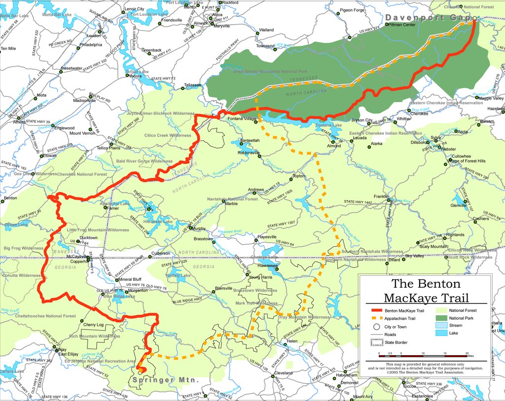
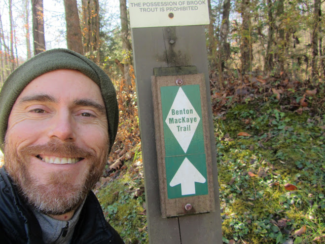
Benton Mackaye Trail
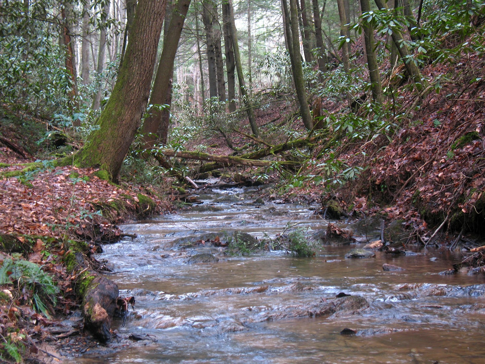
The Benton Mackaye Trail, and eastern hiking in general is not done for awe-inspiring views. The beauty lies in subtle, more intimate moments. The sun filtering through the leaves. Walking through a tunnel of rhododendrons and listening to a nearby creek. The faint smell of vegetation in the air. The interplay of dark greens, soft greys and earthy browns on a foggy day.
Distance: 288 miles (463.5 km)
Start: Davenport Gap, TN
Finish: Springer Mountain, GA
Avg. Time: 20 days
Highest Point: 5,843 ft (1,781 m) – Summit of Mt.Sterling
Lowest Point: 765 ft (233.2 m) – Hiwassee River Crossing
Benton Mackaye Trail Overview Map (Bmta.org)
Getting There & Away:
- For transportation details to both trailheads, see the excellent BMTA hiker resources page.
Season:
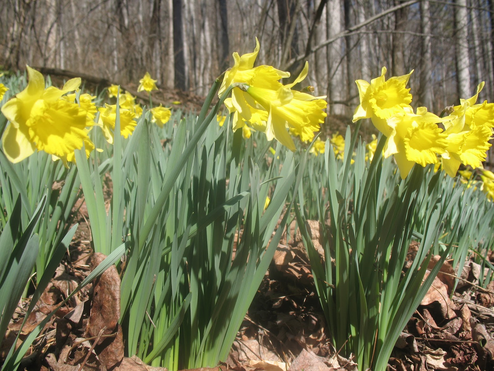
- For our money, spring and autumn are ideal. Yes, the temps can be a little cooler, however, if you time it right, you may just catch the Appalachians at their finest (i.e. flowers blossoming or fall colors).
Spring on the BMT.
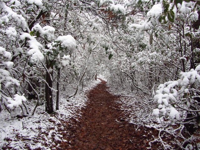
Mid-fall on the BMT.
Maps & Info:
History: The Benton Mackaye Trail is named after the New England conservationist and visionary, who in 1921 first put forward the idea of the Appalachian Trail. The BMT was officially opened on July 16, 2005.
Online Beta: The excellent Benton Mackaye Trail Association website contains up-to-date information on trail conditions, resupply options, shuttles and links to other helpful resources. It also has an online store in which you can purchase maps and guidebooks.
Maps: Paul Mags and I both used a free set of downloadable maps from Chris Johnson (aka Mr Parkay) for our BMT thru hikes in 2009 & 2011 respectively. Unfortunately, as of 2017, these maps are no longer available. Current options include:
- National Geographic Trails Illustrated maps (four in total): Map #777 – Springer and Chohutta Mountains; Map #781 – Tellico and Ocoee Rivers; Map #316 – Cades Cove Elkmont, and; Map #317 – Clingmans Dome Cataloochee. The Trails Illustrated maps are a good choice if you are looking for more of an overview than just the trail corridor.
- Caltopo – Free downloadable USGS 7.5 topographic maps for the entire BMT.
Guidebooks:
- Benton Mackaye Trail Thru-Hiker Guide – Ernest “Sgt. Rock” Engman’s planning guide to the BMT (includes GPS files).
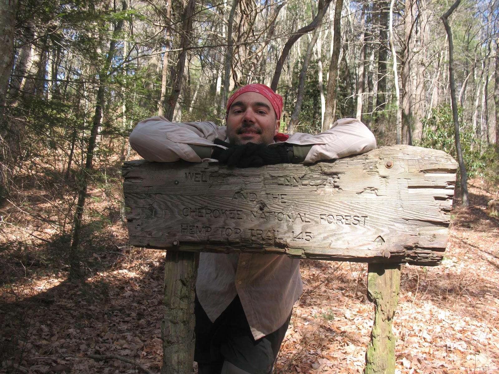
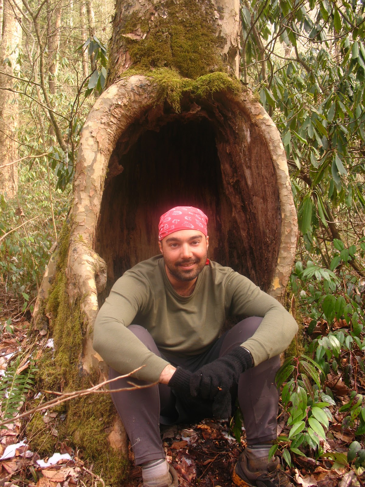
This photo of Paul Mags looking like an Italian-American pirate, graced the
cover of the 2010 edition of Sgt. Rocks BMT Guidebook.
- BMTA Databook – Distances, water sources, trailhead access, elevations, campsites (Note: A lot of this info is covered in Sgt.Rock’s guide. You don’t need to buy both).
- Benton Mackaye Trail Guide Books – There are three in total; Georgia, Tennessee / North Carolina & the Smokies. Each are sold separately.
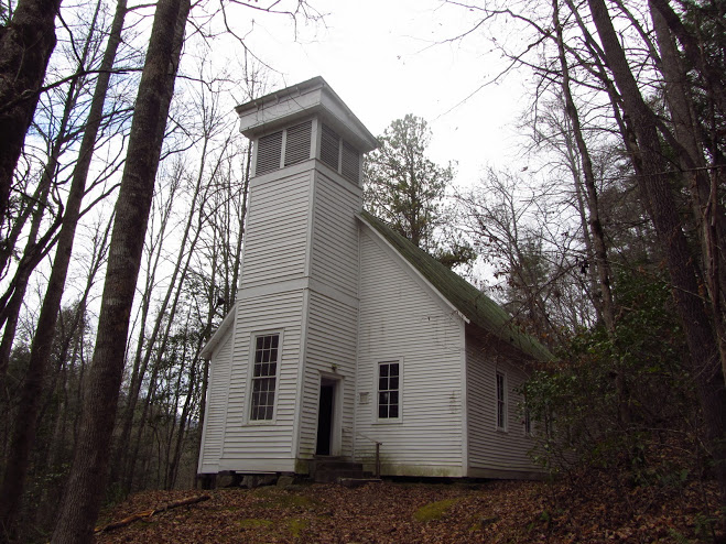
Lufty Baptist Church (established in 1836 / reconstructed in 1912).
- Resupply: Most BMT hikers resupply every 3-5 days. Click here for a comprehensive overview of resupply options on the BMTA website.
- Trail Journal: Return to the Hills – Daily account of Paul Mags’ 2009 BMT thru-hike.
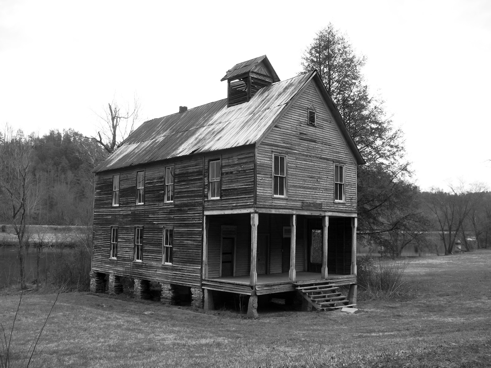
Hiwassee Union Baptist Church | Reliance, TN.
- Permits: The only BMT section you require a permit for is the Great Smoky Mountains National Park. As of 2013, these are no longer free and need to be booked in advance. Click here for details.
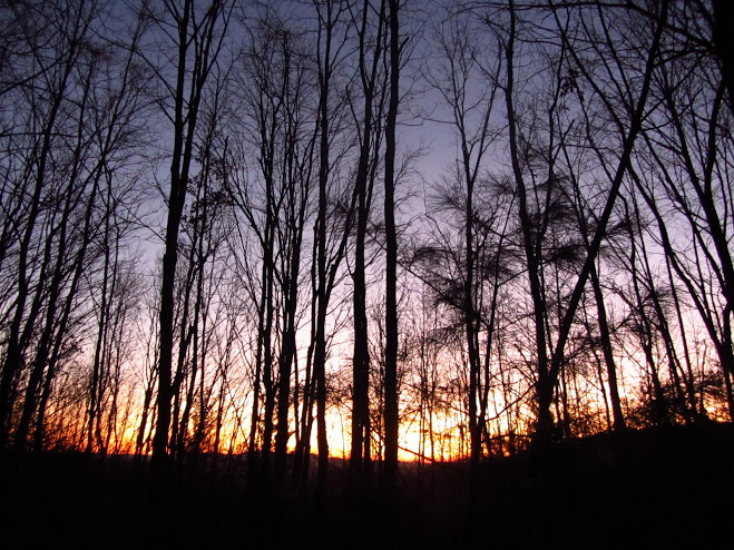
One of the best parts of hiking the BMT after the leaves had fallen, were the
sunrises and sunsets from the ridgetops | November, 2011.
Route:
- Signage & Trail Condition : In the designated wilderness areas there is no signage, however, outside of these sections the BMT is well marked with white diamond blazes. For a pathway that for the most part doesn’t receive a lot of traffic, it is relatively well maintained throughout its course.
- Shelter: Unlike the Appalachian Trail, the BMT has very little in the way of permanent shelters. There are only two, situated at the 50 and 273-mile marks if heading in a SW direction.
- Water: No issues on the H2O front. Sources are plentiful throughout the trail. I can’t remember having to carry more than a liter at any one time.
- Wildlife: If you’re looking for a trail with abundant wildlife viewing opportunities, you may want to look elsewhere. My standout memory on the fauna front was a huge wild hog I spotted on the Lakeshore Trail section (Fontana Dam, NC). It must have weighed around 400-500 lbs. According to local hunters, these boars were introduced from Russia a few centuries back. From the looks of things they haven’t missed too many meals in subsequent years.
- Solitude: I imagine the BMT is what the Appalachian Trail was like 40 years ago. Same mountains, far less foot traffic. During his 2009 thru hike, Paul Mags saw six backpackers (all were within a mile of a trailhead) and in 2011 I saw a whopping two section hikers during the entire 288 miles.
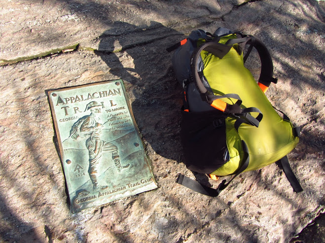
Finish of the BMT & also the southern terminus of the Appalachian Trail |
Springer Mountain, GA.
Reflections
I’ll leave the last word on the BMT to my co-author, Mr. Magnanti:
“What I enjoyed about the BMT is how you’d often look off the ridges and see NOTHING but woods. Very rare out East. The BMT has a remote, almost wild, feel that is not often seen in the Appalachians. If you want a southern Appalachian hiking experience that is more wild than the Appalachian Trail, hike the BMT! I loved the trail and would not hesitate recommending the experience. You do need a little more skills than the typical shelter-to-shelter hiking of the AT, but the rewards of hiking the BMT are wonderful.”
***
Like what you are reading and want to know about some other great hikes? Consider purchasing the Quick and Dirty Hiking Guides for 12 Classic Long Distance Hikes in the US: or 12 Classic Hikes in Colorado.
Good primer about the BMT. Never did it, but thought about it when finishing the Foothills Trail a decade-plus ago. What do you think about a two-month (+/-) hike connecting the Foothills, Bartram, AT, BMT, starting or ending at Table Rock, Springer, or Davenport? Which order would you recommend doing such an endeavor in? Do you know of any online journals or books by someone who has done this? I’m downsizing my life, hoping to retire in about three years, and if healthy enough want to ramp up my backpacking so I could do something like this again. That’s a… Read more »
I’d do the AT first to warm up, use easy resupplies, and generally have an easier time to get your trail legs. Then hook up on the BMT and go from there. I do not know anyone off-hand who has done the link ups you propose per se, but sounds like a great hike! Good luck and have fun! And no matter how you get out there, all good!
Excuse the aside. Hi Skyline. I’ve looked at such a loop after given the idea by a Foothills Tr section hiker as he hiked in a 4 p party when I was completing another FHT thru. I’ve since thru hiked all those trails you listed which peaked interest in the loop even more. His trail name was Nuclear as he and another member in his party were retired Navy nuclear ship personnel. He aptly named it the Nuclear Loop. He was a humble local of the area with a deep knowledge and love of trails, the environment, and the loop.… Read more »
Wow! This sounds awesome. A bit of wildness in the SE Appalachians. Thx for sharing!
If you decide to do this, I hope you’ll post a journal online as a blueprint for others considering the same or similar.
–Skyline
Thanks for your quick response. Good thought about getting my trail legs. I might also consider moving my vehicle once per week or so, hitching/shuttling backward, and hiking toward my vehicle. I did a bunch of the northern AT this way, section hiking. In fact I split the Foothills Trail in two using this scenario. Helps a lot with resupplies, eliminates maildrops/bounce boxes, and as an added bonus can make one very popular with other hikers. 🙂
I found your blog several years ago when I was getting ready to do the BMT in 2013. I thoroughly enjoyed it. When I hiked it in late March/early April, I only saw two day hikers and one or two tents that I passed by in the late evening. I comparison, every time I crossed the AT (they intersect 3 or 4 times), I ran into people. Definitely a big difference!
I love the BMT. A good way to experience the Appalachians without the AT crowds!
I have done sections of the BMT in TN. Never even saw a footprint. Walked up on a Black Bear once North of the Tellico River, but never a person.
My experience too! Awesome trail.
As Mags, and others in the know have said, many hikers flock to named ABC trails. Andrew Skurka and Cam Honan know very well larger longer and shorter treks can be enjoyed piecing named together trails and doing some map scouting. So so much is available in N. America alone that is awaiting to be explored by the innovative creative outside of the box thinking trekkers. We don’t need be the elite trekkers that Andrew and Cam are, and maybe, just maybe, Paul is too, to design our own routes commensurate with individual goals.